Nationwide Ranking Of Crops Grown In Karnataka 2023
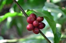
It is a known fact that Karnataka is the privileged destination in India for agriculture, agri-business and food processing industry with immense raw material […]
It is a known fact that Karnataka is the privileged destination in India for agriculture, agri-business and food processing industry with immense raw material […]

The criteria for the formation of the Indian States is language. India became a Republic in the year 1950 and in same year linguistic

Karnataka is blessed with magnificent forests. Karnataka is endowed with different types of forest. Read on to know in detail about the forests in Karnataka.
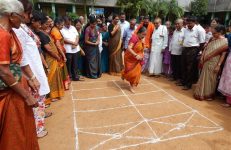
Traditional games have been an integral part of Karnataka’s rich culture. Here are some of the traditional games of Karnataka that can be enjoyed even now.
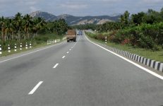
All about district roads in the state of Karnataka. Check out the table showing the length of the major District Roads (MDR) of Karnataka.

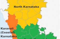
Karnataka receives two monsoons but the rainfall occurrence is not even across the state. Read on to know in detail about the rainfall pattern in Karnataka.
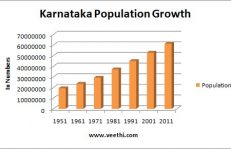
According to the 2011 Census of India, Karnataka’s population stands at 61,130,704 (6.11 crores), which is 5.05 percent of the total population of the
Karnataka is one of the major states in the southern part of the Indian subcontinent. Its territory covers an area of 191,791 square km
Karnataka witnesses three types of climate. The state has dynamic and erratic weather that changes from place to place within its territory. Due to
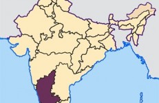
Karnataka is located in the southwest region of India. Spread over an area of 191,791 square km, the state borders the western coast of