Karnataka is situated in the southwestern region of India. It is one of the most prosperous states in India. Karnataka has made tremendous progress in the fields of education, industry, agriculture, literature and tourism. Bengaluru is the capital of Karnataka. Bengaluru is known as the Silicon Valley of Asia due to its flourishing Information Technology industry.
Historical Profile of Karnataka
Karnataka was formed on 1st November 1956 when the States Reorganisation Act came into effect. At that time Karnataka was known as the State of Mysore. It was renamed Karnataka in the year 1973.
Every year 1st November is celebrated as the Kannada Rajyotsava (Karnataka Formation Day). It is done to commemorate the merger of all the Kannada language-speaking areas of South India into a single state. The day is a significant part of Karnataka’s history.
Geographical Profile of Karnataka
Karnataka is the seventh largest state in India in terms of area. It has 30 districts. Karnataka is bounded by the Arabian Sea and the Laccadive Sea on the west, Goa on the north-west, Maharashtra on the north, Telangana on the north-east, Andhra Pradesh on the east, Tamil Nadu on the south-east and Kerala on the south-west.
The major rivers flowing through Karnataka are Cauvery, Kabini, Krishna and Tungabhadra. There are three distinct geographical regions in Karnataka: the Coastal Plains, the Western Ghats and the Deccan Plateau. Karnataka covers about 750 km from North to South and about 400 km from East to West. The coastline of Karnataka stretches for about 320 km.
Demographic Profile of Karnataka
Karnataka ranks ninth in terms of population in India. The population density of the state is 319 per sq. km. The decadal growth rate of Karnataka’s population is 15.7%. Karnataka’s population was recorded as 61.13 million as per 2011 Census of India. Out of this, 61.43% reside in the rural areas.
The sex ratio for the state is 973, which is higher than the all-India average of 940. The sex ratio for rural Karnataka is 979, while for urban Karnataka it is 963. The child sex ratio for Karnataka stands at 948. This figure is again higher than the national average of 914. The overall literacy rate for the state of Karnataka is 75.4%. The male literacy rate is 82.47%. The female literacy rate stands at 68.08%.
Economic Profile of Karnataka
Karnataka is one of the fastest growing states in the country. The state contributed 5.68% to the Gross Domestic Product (GDP) of India in 2014-15. The state offers several incentives under the Karnataka Industrial Policy, 2014-19 to promote the growth of industry in the state. In 2014-15 the state government cleared 108 projects. These projects are expected to generate job opportunities for about 56,000 people.
Karnataka is known as the IT hub of India. About 400 of the Fortune Global 500 companies outsource their IT services to companies in Bengaluru. The state has 47 IT/ITeS SEZs and three software technology parks. Karnataka houses the fourth largest technology cluster in the world. Apart from IT and ITeS sector, Karnataka is also making tremendous progress in Agro & Food processing, Automotive & Aerospace, Education, Machine Tools, Mining & Minerals, Energy and Textile.
Climatic Profile of Karnataka
Karnataka has a dynamic weather. The state experiences three types of climate: arid, semi-arid and humid tropical.
The climate changes from place to place due to the region’s altitude, topography and the distance from the sea. Karnataka receives a mean annual rainfall of around 1355 millimetres. The southwest monsoon brings maximum rainfall to the state. The district of Udupi gets the highest average rainfall while the districts such as Chitradurga, Koppal and Bijapur receive the lowest rainfall.
Transportation Profile of Karnataka
Karnataka is connected with the neighbouring states and other parts of India through a network of National Highways (NH). The 30 districts of the state are interlinked through 153 State Highways (SH). Major District Roads (MDR) help transportation within the districts.
There are two international airports, 13 domestic or regional airports and 15 small airports in Karnataka. The state also has 2 military base airports and 1 flying school airport. Bengaluru and Mangaluru are the two cities with international airports in Karnataka.
There are one major and ten minor ports located across Karnataka’s coastal belt. The only major port of Karnataka is the New Mangalore Port.
Karnataka has a wide-spread railway network. The total length of rail track in Karnataka is 3,089 km. The state has introduced metro railways in the capital city of Bangalore. Bangalore Metro or Namma Metro is being built in phases. At present there are 2 operational metro lines in Bangalore.
Agricultural Profile of Karnataka
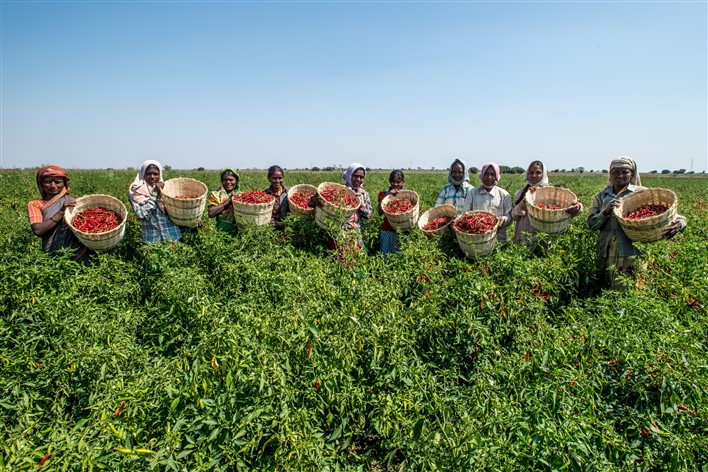
Agriculture is a major occupation for most people in rural Karnataka. About 123,100 sq. km of land is cultivated in Karnataka. This is about 64.18% of the total geographical area of the state. The major crops grown in the state are cereals, pulses, oilseeds and cash crops. Ragi, paddy, maize, jowar, and bajra are the major food crops grown in Karnataka.
The main oil seed crops in the state are sunflower, safflower, groundnut, and sesame. Important crop exports from the state include coffee, tea and mango. Karnataka produces more than 55% of the raw silk produced in the country.
| Quick Facts about Karnataka | |
|---|---|
| Geographical Area | 191,791 square km (74,051 sq. mi) |
| Length | 750 km (North to South) |
| Coastline Length | 320 km |
| Districts | 30 |
| Capital | Bengaluru |
| Population (as per Census 2011) | 6.11 Crores |
| Population Density | 319 per sq. km |
| Rural Population | 61.43% |
| Urban Population | 38.57% |
| Literacy Rate | 75.4% |
| Official language | Kannada |
| Climate | Semi-tropical |
| Rainfall | 500 mm to more than 4,000 mm |
| Geographical Regions | Karavalli, the Coastal Plains; Sahyadris, the Western Ghats and Bayalu Seeme, the Deccan Plateau |
| Rivers | Cauvery, Kabini, Krishna and Tungabhadra |
| Total Forest Area | 43,356.47 sq. km |
| Forest Types | Evergreen and Semi-evergreen, Moist Deciduous, Dry Deciduous, Scrub and Thorny forest, Un-wooded forest |
| Total Road Length | 231,997 km |
| Total Railway Track | 3,089 km |
| Metro Railway | 2 Operational Lines in Bengaluru |
| Ports | 11 ports |
| Airports | 2 international airports, 13 domestic/regional airports and 15 small airports |
| Cultivated Land | 123,100 sq. km |
| Major Crops | Ragi, paddy, sugarcane, maize, jowar, bajra, coconut, groundnuts, coffee, cotton, sunflower |
| Important Crop Exports | Coffee, Tea, Mango |
| Traditional Products | Coffee, silk, sandalwood, incense sticks, ivory carvings, inlay work, lacquer ware |
| Major Minerals | Gold, magnesite, bauxite, iron ore, manganese, limestone, granite |
| Prime Industries | Agro & Food processing, Automotive & Aerospace, Education, Electronics, IT & ITeS, Machine Tools, Mining & Minerals, Energy, Textile |
| Premier Educational Centres | Indian Institute of Management Bangalore, National Institute of Technology Surathkal, National Institute of Mental Health and Neuro Science, Indian Institute of Information Technology, Manipal Academy of Higher Education, Indian Institute of Science |
| Major cities | Bengaluru, Mangaluru, Hubli-Dharwad, Mysore, Belgaum |
Also See
- Boundaries of Karnataka state
- Fauna
- Forests in Karnataka
- Groundnut Festival
- Mattur – The Sanskrit Village of India
- Yakshagana – Dance, Drama and Music
- BSE/NSE listed companies in Karnataka
- Physiography of Karnataka
- Population of Bangalore & Karnataka State
- Water resources in Karnataka
- Heggodu – A Place Where Art and Culture Flourishes
- Traditional Games of Karnataka

